Le bois de Clapisse hike
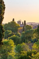
A short walk in a rural setting, alternating between undergrowth and viewpoints.
Itinerary :
From Aujargues, at the Mairie, follow signs for Le Château, Terres Blanches then La Gare.
From this crossroads, follow signs for Corbières et Clapisse, then Pont de Corbières.
From there, follow Bois de Clapisse then Le Château back to Aujargues.
SIGHTSEEING
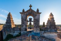
- The late 17th-century church of Saint-Martin.
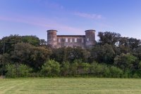
- The château: attested to as early as the 12th century, this was originally a fortified castle.
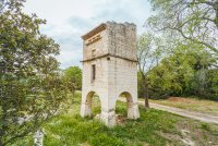
- The 17th-century arcaded dovecote belonging to the château.
- Capitelles in the garrigue: small dry-stone constructions used for shelter or storage.
GOOD TO KNOW :
For thousands of years, the garrigue has been exploited by man: food crops and sheep grazing. The holm oak and Aleppo pine forests were used to make charcoal and glass. These are
very sensitive to fire and should be preserved for their animal and plant diversity. There is also a longer trail, "Le chemin des oliviers", part of which follows the loop shown here.
30250 Aujargues
Means of communication
- Telephone : 04 66 80 99 30
- e-mail : accueil@ot-sommieres.fr
- Pedestrian sports
- Hiking itinerary
Itinerary
- Distance : 5,0 km
- Type : BOUCLE
- Signposted itinerary (Yellow markings)
- Height difference : 89 m.
- Positive difference in elevation : 89 m.
- Duration : 1h30
Equipement
- Parking nearby
Documents
Open
All year round.
Rates
Free access.


