Rando Chemin des pins
Sporty hiking in varied landscapes. Part of this circuit follows the GR 63 Grande Randonnée itinerary.
From the parking lot near the village hall, follow signs for Clairan, passing through Courme, Mas de Coutelle, Cols de Lancyre,
Castignargues and Puech de l'Oule.
At this crossroads, return to Cannes via Le Castellas, Pont des Prades, Bertagnac and Courme.
SIGHTSEEING
- Woods of Aleppo pine, holm oak, kermes oak, downy oak, juniper, arbutus and rosemary.
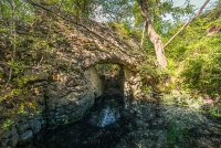
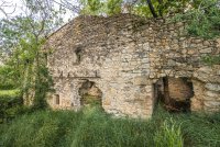
- The remains of a bladier (wheat) mill on the Courme.
- The Castellas (remains of a 12th-century castle) overlooking Montmirat, built on the site of a Celtic oppidum.
- The temple and town hall of Cannes, with similar architecture and the same republican motto.
- From Cannes, a view of the plain.
WORTH KNOWING:
Until 1789, Cannes and Clairan formed two distinct communities. They were reunited in 1790 when the départements were organized. Their coats of arms were merged.
30260 Cannes-et-Clairan
Means of communication
- Telephone : 04 66 80 99 30
- e-mail : accueil@ot-sommieres.fr
- Pedestrian sports
- Hiking itinerary
Itinerary
- Distance : 14,9 km
- Type : BOUCLE
- Signposted itinerary (Yellow markings)
- Height difference : 340 m.
- Positive difference in elevation : 340 m.
- Duration : 4h30
Equipement
- Parking nearby
Documents
Open
All year round.
Rates
Free access.
Environment
- In the country
- Village 2 km away

